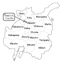
 |
| This row of old-fashoned warehouses were compleated in circa 1740. |
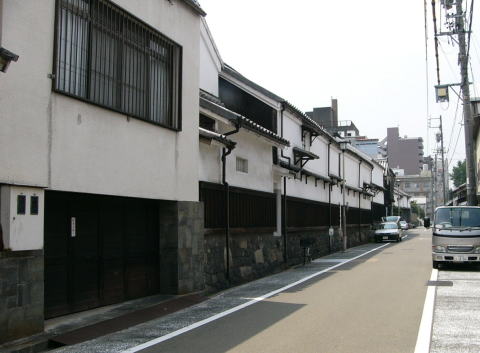
Shikemichi
(ÄlŖįō╣)
Shike(ÄlŖį) means four ken/7.2m, 23.9ft (1ken is 1.82m/5.97ft)
& michi (ō╣) means road.ü@
Shikemichi area was designated as a historic conservation district by Nagoya
City in 1986.
|
| This row of old-fashoned warehouses were compleated in circa 1740. |
 |
 |
Between 1476 and 1610, the seat of the Owari Government was located in
Kiyosu.
(Approx. 7km northwest of Nagoya and there was Kiyosu Castle.)
****
In 1610, Tokugawa Ieyasu (shogun) commanded the relocation of
the capital of the Owari Clan from Kiyosu (approx. 7km north-west of Nagoya)
to Nagoya.
Then, city of sixty thousand inhabitants had started to moved completely
to the new town Nagoya; people, houses, temples, shrines, place names,
etc.
While the construction of Nagoya Castle, a surrounding castle town was
built in parallel.
The town was created by design.
People could live only in designated area according to their class.
This sudden migration was called Kiyosu-goshi.
This migration was done to defend against a possible attack from west,
which
means an attack from Toyotomi side troopes, and also to avoid floods of
the Gojo River.
Nagoya Castle was built at the north edge of the Nagoya diluvial tableland,
natural fortfication.
Nagoya is roughly devided into three configurations. |
|
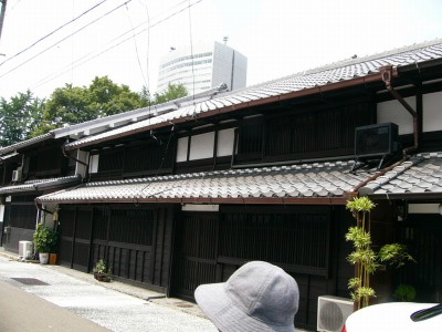
A Horikawa canal was constructed from the port of Atsuta to Nagoya Castle
in order to carry building materials to build a castle.
(Atsuta Shrine was faced to the sea in the Edo period)
Merchants had to build their office buildings facing to the canal and warehouses
with plaster wall on the back of them in a row.
They trade in rice, salt, miso, sake, fuel, etc. using the canal to transport
their merchandise.
and provide them to the people in the castle town.
This area became a commodity distribution center and prospered.
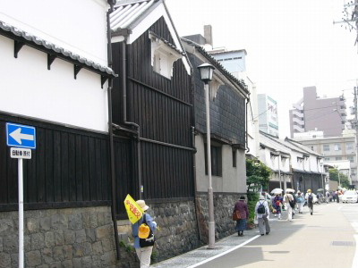
However, a huge fire in 1700, called Genroku-no-Taika, destroyed 1649 merchant's
houses and 15 temples or shrines
The 4th lord of Owari Clan, Tokugawa Yoshimichi, decided to widen the back
street of Horikawa canal
to four "ken", approx. 7m, and build warehouses with plaster
wall on the east-side of the road as fire walls.
It took approx. 40 years to finish the construction.
This is responsible for the name of Shikemichi.
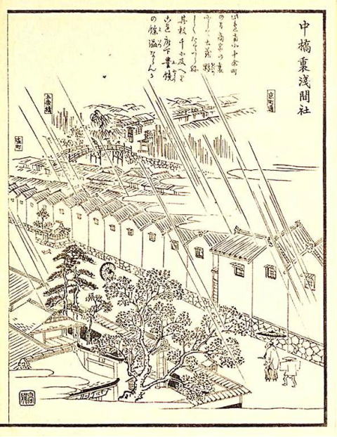 |
| Picture of Sengen Shrine. From "Owari meisho Zue" published in 1844.(In the Edo period) The bridge in the picture is Gojo Bridge. (Please check the map below) |
*****
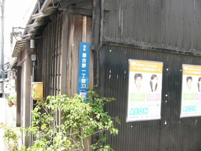
Please take care and try to find a blue sign of "ō▀ī├¢ņłĻÆÜ¢┌éRéRöįÆn"(pic
below)
(Nagono Itchome sanjusan-banchi) on the wall, opposit side of the warehouses.
Turn that corner, you will find something intersting.
 |
 |
*
 |
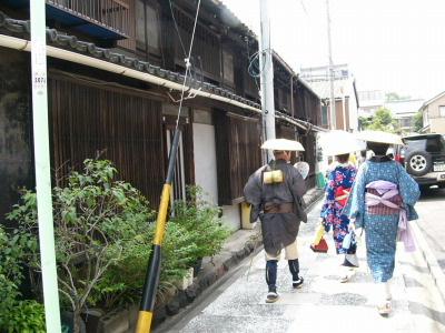 |
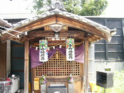
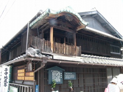
| Komori Jizo | Travelers in the costume of Edo Era |
 |
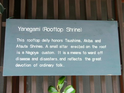 |
| Yanegamisama | About a rooftop shrine |
Address
Nagono, Nishi-ku
Access
Get off at Kokusai-Center Sta. on the Sakuradori Subway Line.
Walk 4 /5 min.
or
Get off at Marunouchi Sta. on the Tsurumai Subway line.
Walk 10 min.
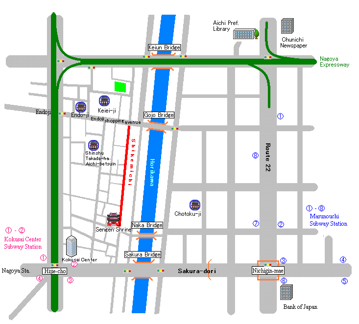 |
| ć@- ćC Kokusai Center Sta. Exit (Sakuradori Subway Line).........ć@ ćAćF ćGMarunouchi Sta. Exit(Tsurumai Line) ćBćCćDćEMarunouchi Sta. Exit(Sakuradori Line) |
![]()